
Zum Inhalt springen

Wild Atlantic Way, stage 1 of 15: Kinsale to Skibbereen

Rundtour ab The Municipal District of Bandon-Kinsale · Irland · County Cork
Entfernung 10766,6kmmi
Höhenmeter 1.3954.580mft
Dauer 2:11 h
Routentyp Von A nach B
Kurvigkeit Hoch

Unterwegs

0 km0 miThe Municipal District of Bandon-KinsaleStart
107 km67 miCounty Cork, IrelandZiel

Über diese Route

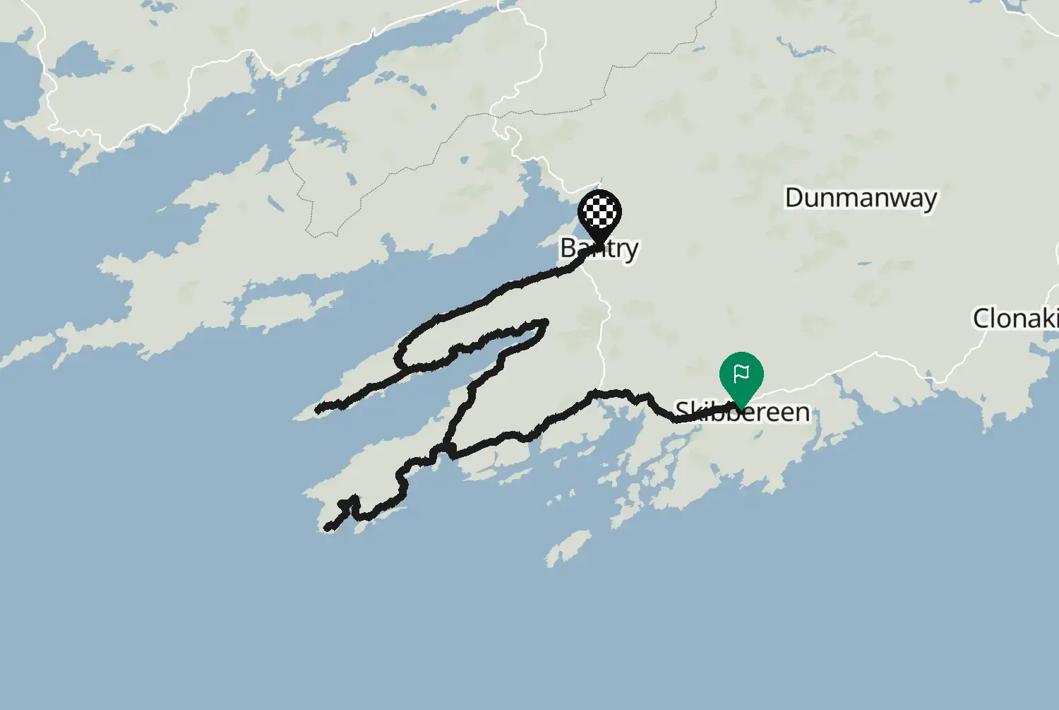
Von Kinsale nach Westen an der Küste von West Cork entlang, über Kilbrittain, Clonakilty und Rosscarbery nach Skibbereen. Kleine Küstenstraßen mit Kurven, Stränden, Flussmündungen und bunten Dörfern, dazwischen belebtere Ortsdurchfahrten. Ein entspannter erster Tag. Dies ist eine von 15 Etappen der Küstenroute, die als Wild Atlantic Way bekannt ist, von Kinsale im County Cork bis Muff im County Donegal. Die Stichstraßen zu Landspitzen und Aussichtspunkten sind nicht dabei, so kannst du selbst die dazunehmen, die dich reizen. In Irland fährst du links, Tempolimits sind in km/h ausgeschildert. Viele Küstenstraßen sind schmal, mit Steinmauern direkt am Fahrbahnrand: Rechne damit, für Traktoren, Reisebusse und Wohnmobile in eine Ausweichstelle zu fahren, und achte auf Schafe und auf Rollsplitt, den der Regen auf die Straße spült. Am schönsten von Mai bis September; für Juli und August buchst du deine Unterkunft besser im Voraus.

Informier dich vor der Fahrt über Straßenzustand und Sperrungen.

Streckenverlauf: Fáilte Ireland, Wild Atlantic Way Route, veröffentlicht auf data.gov.ie, lizenziert unter CC BY 4.0 (https://creativecommons.org/licenses/by/4.0/): https://data.gov.ie/dataset/wild-atlantic-way-route1. Von Motarva bearbeitet: auf die Straßen gelegt, Stichstraßen zu Landspitzen und Aussichtspunkten weggelassen, in Etappen aufgeteilt, Lücken per Routenberechnung geschlossen. Dies ist keine offizielle Routendatei, und Fáilte Ireland befürwortet sie nicht; Wild Atlantic Way ist ein Name von Fáilte Ireland und wird hier nur verwendet, um die Route zu beschreiben.

Quelle Fáilte Ireland, Wild Atlantic Way Route (data.gov.ie) Wild Atlantic Way Route (data.gov.ie, Fáilte Ireland data, 2020), stage 1 of 15. Changes: snapped to roads, side roads to headlands and viewpoints left out, split into stages, gaps filled by routing.
Lizenz: CC BY 4.0 Von Motarva bearbeitet. Keine offizielle Veröffentlichung der Quelle.

1 Downloads
16 Aufrufe
0 gefahren
0 gespeich.
203°/km Hoch
100200NiedrigMittelHoch0300+AutobahnMoselArdennen203°/km
020406080100020406059 mkm 0Hoch 268190 ftmi 0Hoch 2686 mkm 1,8Hoch 26820 ftmi 1,1Hoch 26818 mkm 3,6Hoch 30060 ftmi 2,2Hoch 30078 mkm 6,7Mittel 135260 ftmi 4,2Mittel 135115 mkm 8,1Mittel 115380 ftmi 5Mittel 11589 mkm 9Mittel 115290 ftmi 5,6Mittel 11553 mkm 10,8Mittel 179170 ftmi 6,7Mittel 17913 mkm 12,5Hoch 24040 ftmi 7,8Hoch 24068 mkm 15,7Hoch 279220 ftmi 9,7Hoch 279103 mkm 17,5Niedrig 30340 ftmi 10,9Niedrig 3088 mkm 19,3Mittel 145290 ftmi 12Mittel 14565 mkm 21,1Mittel 107210 ftmi 13,1Mittel 1072 mkm 22,9Hoch 23210 ftmi 14,2Hoch 23221 mkm 24,2Mittel 14870 ftmi 15Mittel 14814 mkm 26Mittel 14850 ftmi 16,2Mittel 1489 mkm 26,9Mittel 19730 ftmi 16,7Mittel 19710 mkm 30Hoch 26730 ftmi 18,7Hoch 2677 mkm 30,9Hoch 26720 ftmi 19,2Hoch 26733 mkm 33,6Mittel 160110 ftmi 20,9Mittel 16069 mkm 35,4Mittel 142230 ftmi 22Mittel 14265 mkm 37,2Niedrig 96210 ftmi 23,1Niedrig 9680 mkm 37,6Niedrig 96260 ftmi 23,4Niedrig 9650 mkm 40,8Niedrig 100160 ftmi 25,3Niedrig 10025 mkm 41,2Niedrig 10080 ftmi 25,6Niedrig 10016 mkm 43Hoch 36350 ftmi 26,7Hoch 3637 mkm 45,7Hoch 29620 ftmi 28,4Hoch 29611 mkm 47,1Mittel 12040 ftmi 29,2Mittel 12034 mkm 49,3Hoch 230110 ftmi 30,6Hoch 23018 mkm 50,2Hoch 33360 ftmi 31,2Hoch 333113 mkm 52,4Mittel 174370 ftmi 32,6Mittel 17457 mkm 55,1Mittel 140190 ftmi 34,3Mittel 14057 mkm 55,6Mittel 140190 ftmi 34,5Mittel 14056 mkm 58,3Hoch 242180 ftmi 36,2Hoch 24224 mkm 59,2Hoch 24280 ftmi 36,8Hoch 2425 mkm 61,4Mittel 11420 ftmi 38,2Mittel 11431 mkm 64,1Mittel 150100 ftmi 39,8Mittel 1508 mkm 65,4Mittel 15030 ftmi 40,7Mittel 15065 mkm 67,7Mittel 190210 ftmi 42,1Mittel 19018 mkm 69,5Hoch 22260 ftmi 43,2Hoch 22255 mkm 69,9Hoch 222180 ftmi 43,4Hoch 22223 mkm 73,1Hoch 30580 ftmi 45,4Hoch 30514 mkm 73,5Hoch 30550 ftmi 45,7Hoch 30512 mkm 76,2Hoch 27440 ftmi 47,3Hoch 27417 mkm 77,1Hoch 27460 ftmi 47,9Hoch 27456 mkm 79,8Hoch 245180 ftmi 49,6Hoch 24564 mkm 80,7Hoch 411210 ftmi 50,1Hoch 41135 mkm 83,8Hoch 584110 ftmi 52,1Hoch 58419 mkm 84,3Hoch 21160 ftmi 52,4Hoch 21122 mkm 86,1Mittel 16370 ftmi 53,5Mittel 16383 mkm 89,2Mittel 200270 ftmi 55,4Mittel 200101 mkm 89,6Mittel 200330 ftmi 55,7Mittel 20059 mkm 91,4Hoch 287190 ftmi 56,8Hoch 28733 mkm 93,2Hoch 218110 ftmi 57,9Hoch 21812 mkm 95,9Mittel 13240 ftmi 59,6Mittel 13238 mkm 97,7Mittel 187120 ftmi 60,7Mittel 18710 mkm 99,9Hoch 33830 ftmi 62,1Hoch 33820 mkm 101,3Mittel 11670 ftmi 62,9Mittel 11614 mkm 102,6Mittel 16750 ftmi 63,8Mittel 16710 mkm 105,3Mittel 17730 ftmi 65,4Mittel 1774 mkm 106,2Mittel 17710 ftmi 66Mittel 177
34,8 von 107 km in Kurven21,6 von 66,6 Meilen in Kurven32%

Auf der Route selbst gemessen, ohne Kreisverkehre und Auffahrten. Kurven werden gezählt, nicht bewertet.

Melde dich an, um eigene Fotos dieser Route hinzuzufügen.
Kostenlos mit einem Motarva-Konto.
Noch keine Fotos. Füge das erste hinzu.
Melde dich an, um diese Route zu bewerten.
Kostenlos mit einem Motarva-Konto.
Melde dich an, um das Wetter entlang dieser Route zu sehen.
Kostenlos mit einem Motarva-Konto.
Herunterladen